
Contour lines plugin — OsmAnd
by OsmAnd
Version 100,000+ 💾 63 Kb
📅 Updated Learn More
Contour lines & Hillshade for OsmAnd Maps (SRTM, ASTER, NASA)

Features Contour lines plugin — OsmAnd
Contour lines plugin — OsmAnd is a plugin for Maps & Navigation — OsmAnd app.
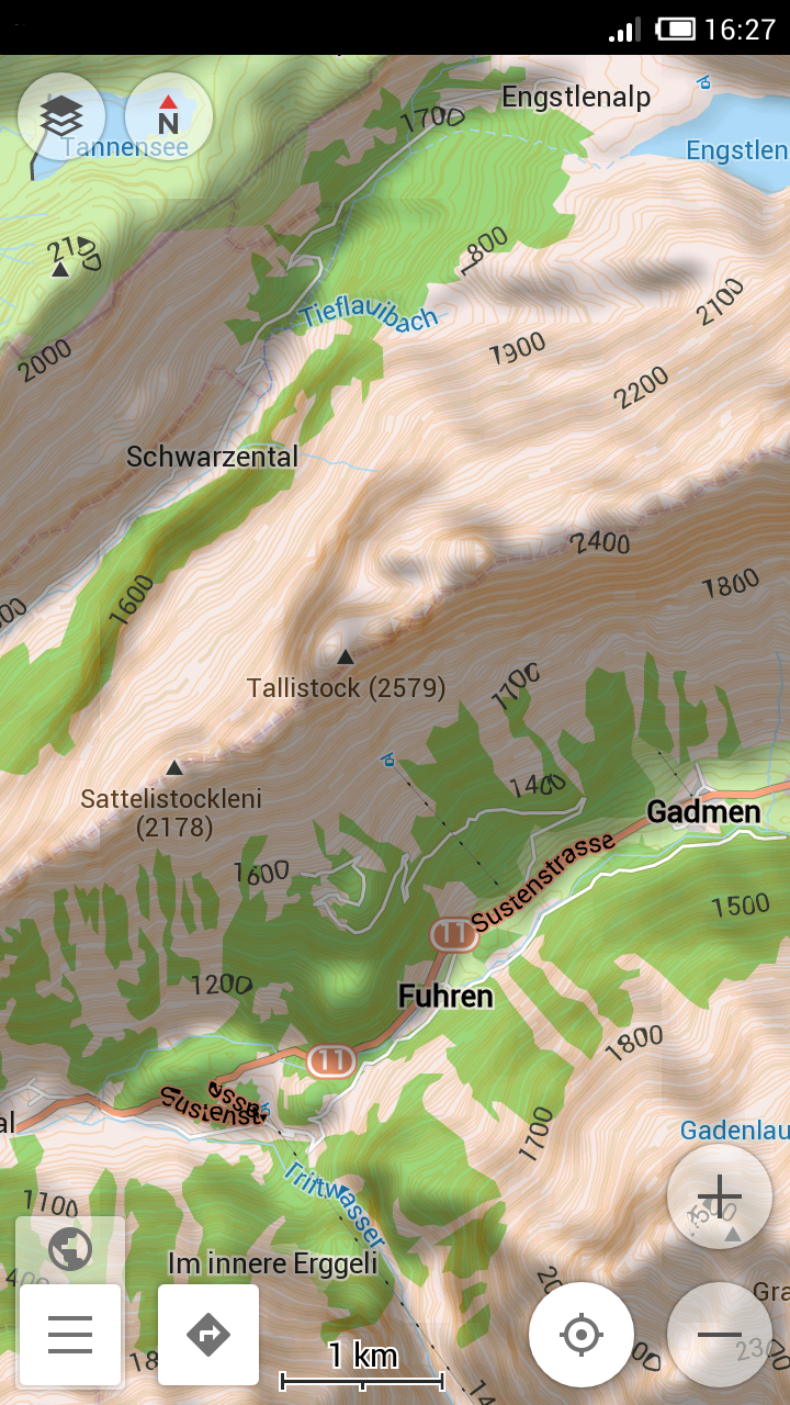
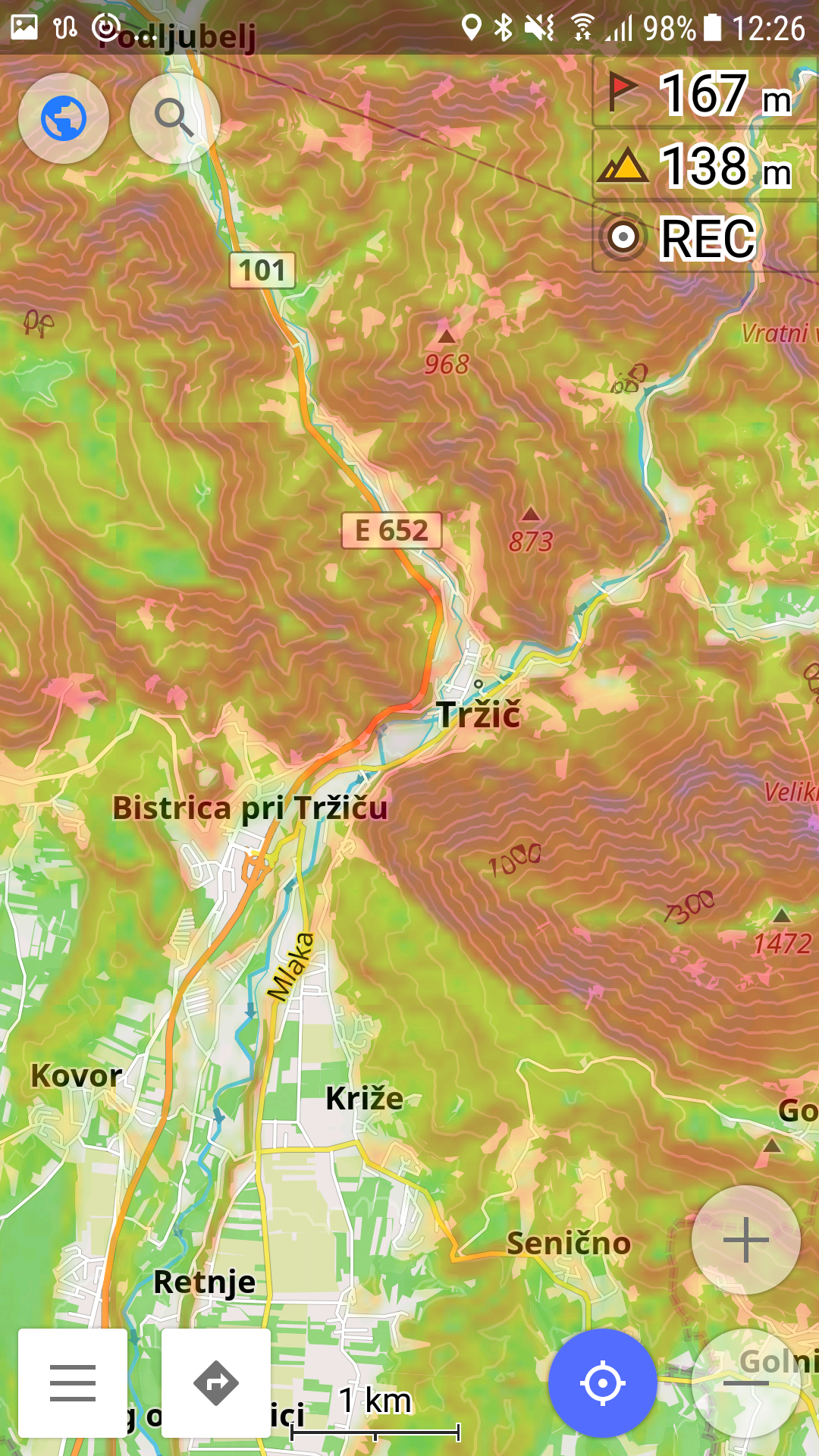
The plugin provides extremely detailed offline topo maps that can be zoomed in and out without losing the quality.
These topographic maps can also be complemented with a layer of 3D terrain representation (hillshade).
Contour lines plugin — OsmAnd is a useful reference tool for hikers, tourists, cyclists, and any topography enthusiast.To download the contour lines and hillshade maps, please go to OsmAnd > Download maps > choose the country you need > Contour Lines/Hillshade.You can enable this layer of information by activating the plugin in OsmAnd > Plugins and also enabling OsmAnd > Configure map > Contour Lines/Hillshade layer.The global data (between 70 degrees north and 70 degrees south) is based on measurements by SRTM (Shuttle Radar Topography Mission) and ASTER (Advanced Spaceborne Thermal Emission and Reflection Radiometer), an imaging instrument onboard Terra, the flagship satellite of NASAs Earth Observing System.
ASTER is a cooperative effort between NASA, Japans Ministry of Economy, Trade and Industry (METI), and Japan Space Systems (J-spacesystems).* Removed icon from the application list
Secure & Private
Your data is protected with industry-leading security protocols.
24/7 Support
Our dedicated support team is always ready to help you.
Personalization
Customize the app to match your preferences and workflow.
See the Contour lines plugin — OsmAnd in Action
What Our Users Say
Don't just take our word for it. Here's what our users have to say about our Android app.
"There are bugs with purchases of this app applying and permitting the download of maps. Developers close all tickets relating to it and tell people to contact support. Support have no answers. Developers: Unprofessional, lacklustre effort, no questions, no engagement, no debugging. Only effort is that expended on preemptively closing tickets."
B K
"I've updated my review to give stars since they updated the plugin. It will now ask which units you would like your contour lines displayed in."
John Saathoff
"Good"
Javed Sheikh
"Does the job. Not sure why the one stars reviews. Without hillshading its rather blah, but it works. Update...the Plugin installs with latest OsmAnd version, but depending on android version, the .srtm files go different places."
Christi M
"Help, downloaded the contour line map and local area contour map. No relief lines displayed. Enabled plugin in the main app. I'm running Android on a Motorola Action One."
sdpupsdad
"Most useful for seeing what's on the path ahead"
Adam Povey
"Works like a charm. Ideal with hillshade to show mountains. I use it for hiking a lot ❤️"
K.
"Good open source app with no trackers"
User Name
"Works fine for me, I just bought it, for this 5 star review Dev should offer me the osmand live for lifetime 😉 cause those low ratings just dont know how to use it I guess, after it installed it worked right away for me. Kudos to the Dev, I switched over from Locos Pro"
oi Sassy Maate
"Stopped working, nothing helps"
O Smart
Get the App Today
Available for Android 8.0 and above